Geospatial Analysis Links West Coast Submarine Canyons to UAP Report Clusters, Prompting Calls for Naval Sonar Transparency


A growing body of open-source reporting and military accounts continues to test the boundary between unexplained aerial observations and conventional explanations. A new geospatial analysis by Warsaw-based researcher Anthony Wedikowski has intensified that debate by identifying statistically significant clusters of UAP reports directly above steep submarine canyons along the U.S. West Coast, particularly off California and Washington. The study’s approach—overlaying decades of geotagged public sightings from the National UFO Reporting Center with NOAA high-resolution bathymetry—aims to quantify whether geography correlates with witness reports. According to the presentation, the resulting concentrations are not mirrored along the Atlantic seaboard or Gulf Coast, despite comparable submarine topography and large coastal populations.
The method focuses on abrupt bathymetric gradients—canyon walls with drops greater than 60 meters per kilometer—where the West Coast clusters reportedly align. Notable areas cited include La Jolla Canyon near San Diego, Mugu Canyon, Monterey Canyon, and Puget Sound. The analysis further notes that reported sightings tend to occur in brief bursts rather than as a steady trickle, a pattern consistent with periodic activity around fixed locations. While Wedikowski’s work is not peer-reviewed, he is said to have released the underlying code and dataset to facilitate replication and scrutiny, foregrounding transparency as a prerequisite to broader scientific engagement.
Historical records appear to track with these geographical findings. During the 1960s, Project Blue Book files document multiple cases in the Santa Catalina Channel, which overlies approaches to the same canyon systems highlighted by the new study. One cited 1966 case involving U.S. Navy photographer Lee Hansen reportedly produced clear daylight 16 mm imagery of an elongated object with no conventional control surfaces; it remains unexplained in publicly accessible records. Observations from that era frequently describe luminous objects interacting with the ocean surface, a motif that aligns with modern “transmedium” narratives.
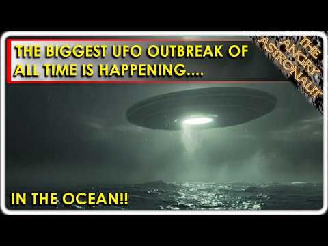
Recent Navy incidents have kept the region under scrutiny. The 2004 USS Nimitz encounter involved aviators reporting a white, oblong object executing rapid altitude changes and accelerations, with the USS Princeton’s radar tracking additional contacts. Accounts from the 2019 USS Omaha include a spherical object that appeared to enter the ocean after being tracked on ship sensors and visually observed. In 2023, a senior chief aboard the USS Jackson described self-luminous objects rising from the water and departing without evident propulsion, reportedly captured on the ship’s infrared system and radar. These cases, while debated, provide multi-sensor threads that advocates view as complementary to the geospatial clustering over canyon terrain.
The oceanographic context offers additional hypotheses. Steep canyon walls can create acoustic shadowing and complex sonar propagation paths, complicating detection. Rapid depth changes near tectonic features may influence local energy environments. Whether such conditions merely confound sensors or could facilitate covert operations—human or otherwise—remains an open question. A separate stream of crowdsourced observations, including entries attributed to the Enigma app, reportedly notes thousands of coastal object reports since 2025, with a subset describing entries to and exits from the ocean surface; these data require independent vetting to assess quality and reporting biases.
Skeptical perspectives emphasize prosaic drivers: classified testing in military ranges, misidentified drones or aircraft, bioluminescent marine life, and social contagion following high-profile cases. Proponents counter that the West Coast canyon correlation, the burst-like temporal patterns, and multi-sensor naval reports warrant targeted, instrumented studies. The most significant barrier identified is the lack of publicly released raw sonar logs and high-fidelity sensor data from naval platforms operating near the hotspots. Ocean mapping campaigns typically average out transient signals, limiting their utility for detecting rapid, small-target transits.
Policy and research advocates have urged methodical surveys of the identified canyons and the comparison of classified sonar records against public UAP clusters. Without access to detailed sensor datasets, conclusive attribution is unlikely. The emerging consensus among transparency proponents is straightforward: make the data available for independent analysis. If validated, the asserted canyon-linked clustering would challenge current assumptions about where and how anomalous phenomena manifest; if refuted, the process would still advance methodological rigor in the field. Either outcome would benefit from systematic data-sharing protocols between defense, scientific, and civilian stakeholders.
Key Moments
- 00:24A study analyzing roughly 80,000 UFO/UAP reports finds clusters aligning with the steepest submarine canyons off California and Washington.
- 00:37One canyon reportedly logged 820 sightings against a population-adjusted expectation of about 55, indicating an anomalous concentration.
- 00:47Multiple Navy accounts describe 'tic-tac' objects emerging from the ocean, maneuvering without observable propulsion, and departing rapidly.
- 01:00Independent researcher Anthony Wedikowski (Feb 28, 2026) compiled geotagged NUFORC data and overlaid it on NOAA high-resolution bathymetry.
- 06:20Method: identify canyon walls with >60 meters of drop per kilometer; West Coast clusters align with these features, unlike the U.S. East and Gulf coasts.
- 06:32Reported hotspots include La Jolla Canyon near San Diego, Mugu Canyon, Monterey Canyon, and Puget Sound.
- 07:08Sightings reportedly occur in short, intense bursts, consistent with traffic to and from fixed locations; the study shares code/data for replication but is not peer-reviewed.
- 09:49Historical context: 1960s Project Blue Book files reference Catalina Island/Santa Catalina Channel incidents near the same canyon systems.
- 10:35A 1966 case involving Navy photographer Lee Hansen allegedly captured a metallic, elongated object on 16 mm film near Catalina; the clip remains unexplained in open files.
- 14:182004 USS Nimitz event: Commander David Fravor described a 'tic-tac' dropping from high altitude to sea level and accelerating rapidly; USS Princeton tracked multiple contacts.
- 15:372019 USS Omaha: crew observed a spherical object tracked on sensors and visually; it appeared to enter the ocean; pyramid-shaped objects near USS Russell remain unidentified.
- 16:252023 USS Jackson: a senior chief reported self-luminous 'tic-tac' objects rising from the water and accelerating; shipboard sensors reportedly recorded activity.
- 17:24Key data gap: no public release of raw Navy sonar logs; advocates, including Rear Admiral Tim Gallaudet, urge targeted sonar surveys of canyon hotspots.
- 19:35Skeptical alternatives cited include classified drones, misidentification, bioluminescence, and reporting bias; proponents argue multi-sensor cases and statistics merit deeper inquiry.
Related Topics
Links & References
No additional links available.
 Continue with Google